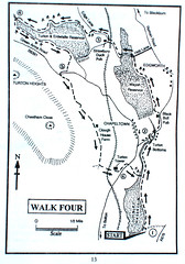
The three reservoirs are a linked set of lakes in the West Pennine Moors just north of Bolton and consist of the Jumbles, Wayoh and Turton & Entwistle reservoirs. The whole walk is approximately 8 miles in length and take in a height gain of about 500 feet or so.
Boots on and waterproofs in the rucksack, we set off from the car park at the southern end of Jumbles Reservoir heading along the path at the side of the lake. It wasn't long before the primary theme of the day made itself known - intermittent drizzle. However, we were pretty well prepared so the thought of abandoning the walk just didn't surface.
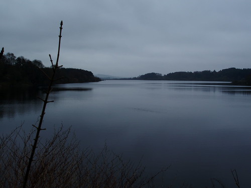
At the far end of the lake, we followed a tree-lined valley towards Turton Bottoms where we climb up through the village to Wayoh reservoir (where the name comes from, I've no idea). Again, we followed a tree-lined path on the bank of the lake. In good weather, the views and countryside would have been magnificent, but as it was, the cloud was low over the hills, and the sun never had a chance to come out.
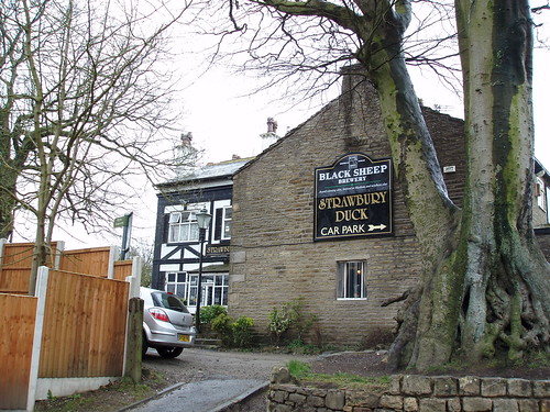 At the far end on Wayoh Reservoir we reached Entwistle and the Strawberry Duck Inn where we had lunch. The food was very good and plentiful and the beer excellent. They serve a very good Black Sheep bitter and their own brew - Strawberry Duck Ale - brewed by a local brewery especially for the pub. The pub is very popular and we arrived at just the right time. Any later and we would not have been able to eat as it was so full.
After lunch, we climbed up to the third reservoir, the Turton & Entwistle Reservoir. By this time, the drizzle was less intermittent and more constant, but as
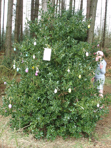 we were at the point where it would have been just as far to go back as it was to go on, - we went on. Part way along the path, someone had decorated a holly bush with Easter Eggs (plastic, not chocolate I'm afraid) as an Easter Tree. Quite unexpected, but very pretty non-the-less. Eventually, we reached Yarnsdale at the far end of the lake and the point where we turn back towards the car and home.
When we reached the Turton & Entwistle Reservoir dam, we left the lakes to follow a path across the moors back to the Jumbles Reservoir and our starting point. This path marked the highest point on the walk, and the downhill stretch was very welcome. Before long, we were back at our starting point, tired, damp but very happy at what we had achieved. It has now got us thinking about future walks in the summer.
1 comment:
Post a Comment